Geographic Information Systems and Technology Center of Perm State National Research University (GIS Centre of PSNRU) was established in September 2000, on the scientific-research basis of Perm State University at the decision of the Coordination Council for the development of geographic information systems of public authorities (GIS PA) of Perm region. The creation of a network of GIS centers took place according to the Concept of GIS PA of Perm region for 1999-2001, approved by the governor of the region from 22.03.99 № 93, and GIS PA Program of Perm region for 2000-2001., approved by the governor of the region from31.12.1999 № 223.
From September 2000 to October 2005 the scientific adviser of the cetre was the first vice-rector of the University, doctor of technical sciences Vladimir M. Suslonov. Since February 2006 and by the present the scientific adviser isthe first vice-rector of PSNRU, PhD, associate professor Valery A. Sherstnev.
Sergey V. Pyankov, the candidate of technical science, associate professor, has been the head of the GIS center.
The GIS centre started to realize its scientific and practical activity in September, 2002, after the list of staff members and first contracts to perform research work appeared. The centre was licensed on October 15, 2002 by Roskardography RF № URG-00596 for the following activities:
- creation and maintenance of geo-information systems for special purposes;
- making, updating, preparation for publication, edition, copy in graphic, digital (electronic) and other types of thematic maps, plans and atlases for special purposes;
- making, updating, preparation for publication, edition, copy in graphic, digital (electronic) and other types of calendars, guides and other promotional and informational publications on the cartographic basis or with its use;
- performance of research and experimental-design projects in the field of GIS technology.
Since that time the GIS Centre began its activity on the territory of Perm region. Environmental Protection Department of Perm region became the main customer of projects. Three works should be noted among the first research projects which later were developed and became the GIS Centre general response:
- “Perm region zoning according to the ecological risks of natural and natural-technogenic emergency cases: territory zoning; the creation of a data bank for the geographic information system of public authorities (GIS PA) “
- “The creation of a digital model of the Kamskoye and Votkinskoye reservoirs relief bottom to conduct the monitoring subsystem of water biological resources within ecological monitoring framework.”
- “The structuring and creation of thematic layers of the environmental section of GIS PAof Perm region: quarterly net,Goslesfond and Mezhhozles forestry borders”
The list of customers and activities has recently extended greatly. Currently the main customers are federal, regional, municipal and large business structures:
- Central administrative board for Civil Defense and Emergencies of Perm Krai;
- FSU “The Kama Basin Water Management”;
- FGU “Kama-Ural basin management for protection and reproduction of fish inventory and the production regulation”;
- Natural Resources, Forestry and Ecology Ministry of Perm Krai;
- Security Ministry of Perm Krai;
- Agriculture and Food Ministry of Perm Krai;
- Management on Environmental Protection of Perm Krai Administration;
- Municipalities of Solikamsk, Berezniki, Krasnovishersk,Tchusovoy and many others.;
- Lt. “Lukoil-Permneft”;
- Lt. “Perm Motorostroitelnuy Zavod”;
- JSC “Institute of Information Systems”;
- PC “Solikamskbumprom”;
- PC “Mineral fertilizers”.
The worked out branches of activity “GIS and natural resources”, “GIS and Safety”, “GIS and Ecology” are confirmed byprofound research projects conducted by the GIS center according to the government order: “Scientific and technical substantiation and development of the program” Prevention of waters detrimental effects and hydrolic engineering construction safety in Perm Krai “(2006) (the regional target program was approved by the Perm krai legislative assembly in January 2007); “Creation of the space monitoring system for forest resources of Perm Krai” (2006-2007); “Creation and maintenance of the ” Forest resources database of Perm Krai ” GIS(2005-2007 );”Creation of the geoinfomation system called ” Forest Resources of PC “Solikamskbumprom” (2008-2009);”Elaboration of the insurance fund of Perm Krai documentation” (2006 – 2007); “Information support of state authorities, local government during the decision-making on public safety, prevention and elimination of natural, technogenic and bio-social emergency situations in Perm Krai municipalities ” (2007 – 2009);“Perm region zoning according to the ecological risks of natural and natural-technogenic emergency cases: territory zoning; the creation of a data bank for the geographic information system of public authorities (GIS PA)” (2002-2004), Befor and after flood inspection of Perm Krai Territory (2007 – 2009).
It’s important to mention that a new branch of activity “GIS and agriculture” appeared in 2005. It has been developed in the ongoing project “Creationof space monitoring system based on the earth remote sensing data for the rational use of agricultural lands” (2005-2008).
The agreement to establish municipal geographic information system (MGIS) of Krasnovishersk was set up in 2003, the MGIS Conception of Berezniki was elaborated in 2005 and the tender for the establishment of municipal geographic information system (MGIS) of Solikamsk municipalitywas won in in 2007. Thus, there is another branch of development – the use of geographic information solutions for municipalities management where GIS is an integrating link for users on any possible space, scale or profile levels.
The resources development of the GIS centre of PSNRU in 2013 is as10 times high as in 2002 г.
Nowadays we have creative, professional and contractual relations with reliable partners. Among them are:
- GIS Association of the Russian Federation (Moscow);
- Data + (Moscow);
- ITC “Scanex” (Moscow);
- Institute of Water Environmental Problems (Barnaul);
- Territorial Fund of Information on Natural Resources and Environment Ministry of Russia for Perm region (Perm) and many others.
Since the establishment and the choice of the development priorities we realized the need to create our own training department. In this regard, the Training Center onESRI software (Environmental Systems Research Institute, USA)- the first centre in the Western Urals- was certificated on November 3, 2003. S.V.Pyankov (“Introduction to ArcView», «Advanced Course of ArcView»), Y.N. Shavnina (“Introduction to ArcView», «Advanced Course of ArcView 3”) and A.V. Nekrasov (“Introduction to ArcGIS», Part 1, 2) became the first certified professors. Since that time, we have an opportunity not only to educate and increase the education level of customers in the use of GIS technology, but also the opportunity for our autonomous learning.More than 150 certificates of various courses have beencurrently issued, including the Perm State Universitystaff. Since February 2005 the ESRI Training Center has been a part of the Regional Institute for Continuing Education of Perm State National Research University.
Since 2014 the students are read the most modern courses: “ArcGIS Desktop I: Getting Started with GIS (Part 1)”, “ArcGIS Desktop II: Tools and Functionality (Part 2)”, “ArcGIS Desktop III: GIS Work processes and Analysis ( Part 3). ” Classes are carried on by a certified instructor, Ph.D. Cherepanova E.S.
Our own computer lab on ESRI software training and the use of modern GIS technologies in the substantiation and management decisions making was openedin December 2007 .
The staff of the GIS Center of PSU regularly participates in regional, federal and international conferences. Among them are GIS forums ofthe Russian Federation (Moscow, 1998 – 2010), GeoSibir (Novosibirsk, 2004-2014), Sustainable Development of Territories: GIS theory and practical experience (St. Petersburg, Russia – Helsinki, Finland (2001), Vladivostok, Russian Federation – Changchun (2005), China; Khanty-Mansiysk – Yellowknife, Canada (2007), Rostov-na-Donu (2010), Belokuriha (2011), Belgrade (2014) and many others.
I Interregional Scientific and Practical Conference “Software of the spatial development of Perm region” was organized and held by the GIS center of PSU in autumn 2008.The aim of the conference was to develop a regional mechanism for the creation and development of spatial data infrastructure of Perm krai for the benefit of state and local authorities in their management decisions making. At the conference it was decided to make it traditional and annual. The series of the conferences have been held for over 5 years.
The Jubilee International Conference InterCarto-InterGIS – 15 “Perm” – “Gent” was held on the basis of the GIS center of PSU in summer 2009. More than 160 participants from Barnaul, Volgograd, Yekaterinburg, Izhevsk, Moscow, Nizhnevartovsk, Nizhny Novgorod, Novosibirsk, Perm, Petropavlovsk-Kamchatsky, Saransk, Tyumen, Khabarovsk and other Russian cities, as well as from Belgium, the UK, Germany, China, Netherlands, the Czech Republic, Estonia, South Korea took part in the conference. They represented organizations that specialize in the field of spatial planning, geoscience, geoinformatics, cartography, geology, mining and oil and gas transportation, higher education. By the beginning of the conference three volumes of its materials had been published, including more than 100 publications.
More than 200 articles, preceding papers and abstracts have been published by the GIS Center staff, 21 of them are included in the list of HAC. The main topics of publications are the creation and use of modern geoinformation methods in spatial tasks decisions.
Much work is done to improve the skills of the GIS center employees. Each of them takes at least 2 courses of ArcView 3.2a, ArcGIS 10.2 training. Besides key specialists are educated in organizations and companies that arethe leaders in the field of geoinformatics in the territory of the Russian Federation:
- Certificate of participation in the International School of Young Scientists “Computational-informational technologies for environmental sciences: CITES-2007”, 14-25 July 2007 – Y.N. Shavnina (Tomsk State University);
- Certificate of the course “Basics of ArcGIS Spatial Analyst», October 10, 2007 – Y.N. Shavnina (Moscow, Date +);
- Certificate of the course “Introduction to ScanMagic», January 2011 – E.S. Cherepanova, A.N. Shikhov (Moscow, Scanex);
- Certificate of the course “ArcGIS Desktop I, II, III”, April 2014 (Moscow, Date +);
- Certificate of the course ” Geodatabase Construction”, 2014 – E.S. Cherepanova (Moscow Date +);
Hardware, software, information and technological equipment is purchesed, created and developed. Currently we have the most modern stock of computers and peripheral devices (including plotter, large format scanner, GPS-navigation).
The GIS center consistently, since its establishment, purcheses and develops software tools. We have a certified software of leading foreign and Russian companies-developers in geographic information systems and technologies: ArcView 3.2a (extensions Spatial Analyst; 3D Analyst; NetWork Analyst) («University set”); ArcGIS 9.2 (extensions Spatial Analyst; GeoStatistical Analyst; 3D Analyst; NetWork Analyst) («University set”); ArcGIS 9.2 (extensions Spatial Analyst) (floating license); ArcEditor (floating license); EDN (floating license) (all software is the software product list of ESRI). ERDAS IMAGINE Professional (extensions: Vector; Virtual GIS, OrthoBase, Radar Mapping System, MapSheets) (software products list of ERDAS) («University set”), as well as ScanMagic (Scanex) are licensed software products for data processing of remote sensing (satellite imagery) .
The first regional geoportal for the territory of Perm Krai has been created. We take actions to implement a single geodatabase as the topographic foundation for applied problems solutions at the regional level (modeling of snowmelt, the high waters and floods formation, droughts and flooding prediction and other natural and anthropogenic processes). Weprepare materials for the certification according to FSC standard.
To realize a number of projects in 2006 we purchasedsatellite images of the Perm Krai territory with a resolution of 6 m (2005-2007, IRS LISS), that allowed to identify spatial objects with generalization M 1:50000. In its turn, it extended a broad group of monitoring tasks associated with spatial modeling of changes in vegetation cover, rivers and reservoirs banks processing, illegal anthropogenic impact on the environment. Currently, the entire territory of Perm Krai is covered withimages with a resolution of 2.5 m (M 1:25000) with 1 mdetailed insets.
In 2009 PC “Scientific and Production Corporation” REKOD “and the State Educational Institution of Higher Professional Education” Perm State University “signed the agreement on cooperation in the field of space activity results use (RSA).
One of the main cooperation ares is the joint creation and development of “Space Services Center” on the basis of PSNRU. This decision has led to the creation of the innovationcompany Lt “MICspace technologies and services Center.”
In 2009,the scientific and educational center SEC “Mathematics and cartographic modeling of geosystems and complexes” was established on the basis of the GIS centre. The main goal of SEC is to develop a new scientific and educational structure, aimed at the development of basic research in mathematics and earth sciences, as well as the formation of new training schemes and the organization of education advanced scientific research and high technology.
In 2010, Perm State University received the status of National Research University (NRU) with the program “Efficient environmental management: forecasting technologies and management of natural and socio-economic systems.” Thus, a unique concentration of personnel, ideas, technology and finance appeared, which allowed for the first time in 9 years to conduct the first government funding of applied science and education activity of GIS center of PSNRU.
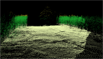
On February 14, 2011 Interregional Center of Space Monitoring (ICSM)of Perm region was established on the basis of the GIS center of Perm State National Research University. The centreincluded two satellite receiving stations: “Alisa – CK” and “UniScan – 24.” The first station now allows to receive data from two types of satellites: NOAA (POES), MetOp, and the second one- from Modis (Terra / qua), Spot-4-5, and EROS A / B. Thus optical survey has completely covered a number of large-scale remote sensing data as well as a wide range of current thematic tasks.
Currently the received satellite monitoring system is widely used in the investigation of natural-territorial complexes of different hierachical level and territorial coverage. The main advantage of ICSM is information efficiency that can not be obtained when ordering data through INTERNET. Furthermore, it should be noted that the remote sensing methods are significantly more economical ways in comparicon with the traditional spatial data gathering.
TheCenter of Space Monitoring is installed on an “open architecture” principle, that allows,if necessary, to add blocks and modules. The centre configuration on the reciving principles can vary, thatallows to develop the ICSM in time, extending the range of tasks solved by it. The dynamics and the direction of the development is determined by, first, the acute needs of practical problems in the region, secondly, by the existing technical opportunities, and thirdly, by the considerations of economic expediency.
Comprehencive processing of space information and ground-based measurements results is the basis for the target data organisation necessary for decoding and case studies held for the objective information about the current state of the region. The results of processing are integrated into the thematic GIS to conduct a comprehensive analysis and information about the dynamics of positive and negative territorial and object processes. Such information makes it possible to make deliberate decisions that greatly improve the efficiency of regional and local governments in various functioning areas of the entities.
In September 2011, the first base reference station in Perm was put into test operation. It was based on the specialized GNSS-receiver AshTech ProFlex500 (France). This is the first step in the creation and development of a network of base stations in Perm region.
Functioning network of such stations in future will allow tomake engineering and survey works, the imposition of points in nature and field inventory works with centimeter accuracy having only a GNSS-receiver. It will be poccible toreceive coordinates correctionshaving satellite equipment of AshTech brand, as well as the equipment of third-party manufacturers. Due to the integral RTDS-server, it is possible to operate simultaneously with 90 rovers of all brands and broadcast corrections in any existing formats.
Basic reference station is operating in the test mode now, an evaluation of the quality of positioning on the real terrain is done by the rover AshTech ProMark200 in various modes – Static, Stop-n-Go, RTK. The planned accuracy is 10 mm in RTK within the boundaries of Perm and up to 10 cm in most parts of Perm region. The functioning of the basic reference station provides new opportunities for surveyors using satellite GNSS-receivers. First, it is the cost optimization of engineering research – it eliminates the need to purchase expencive private basic station. Second, it improves the quality of field and office works – high precision characteristics of the equipment and powerful but easy to use software of GNSS Solution will quickly and easily handle the materials of field surveys. The third opportunity concernsthe significant time savings for field work – there’s no need to justify the image development, visibility between points: the basic reference station is tied to the local coordinate system once and for the whole period of its operation.
Professionalism, the dynamics of sustainable development, the experience are the main features of the Geographic Information Systems and Technology Centerof Perm State University.


