Short Description
Goals:
Study the conditions before and after the flood in the territory of Perm Krai.
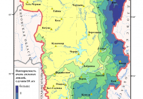
Prediction and monitoring of flood.
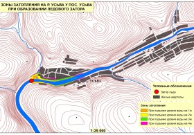
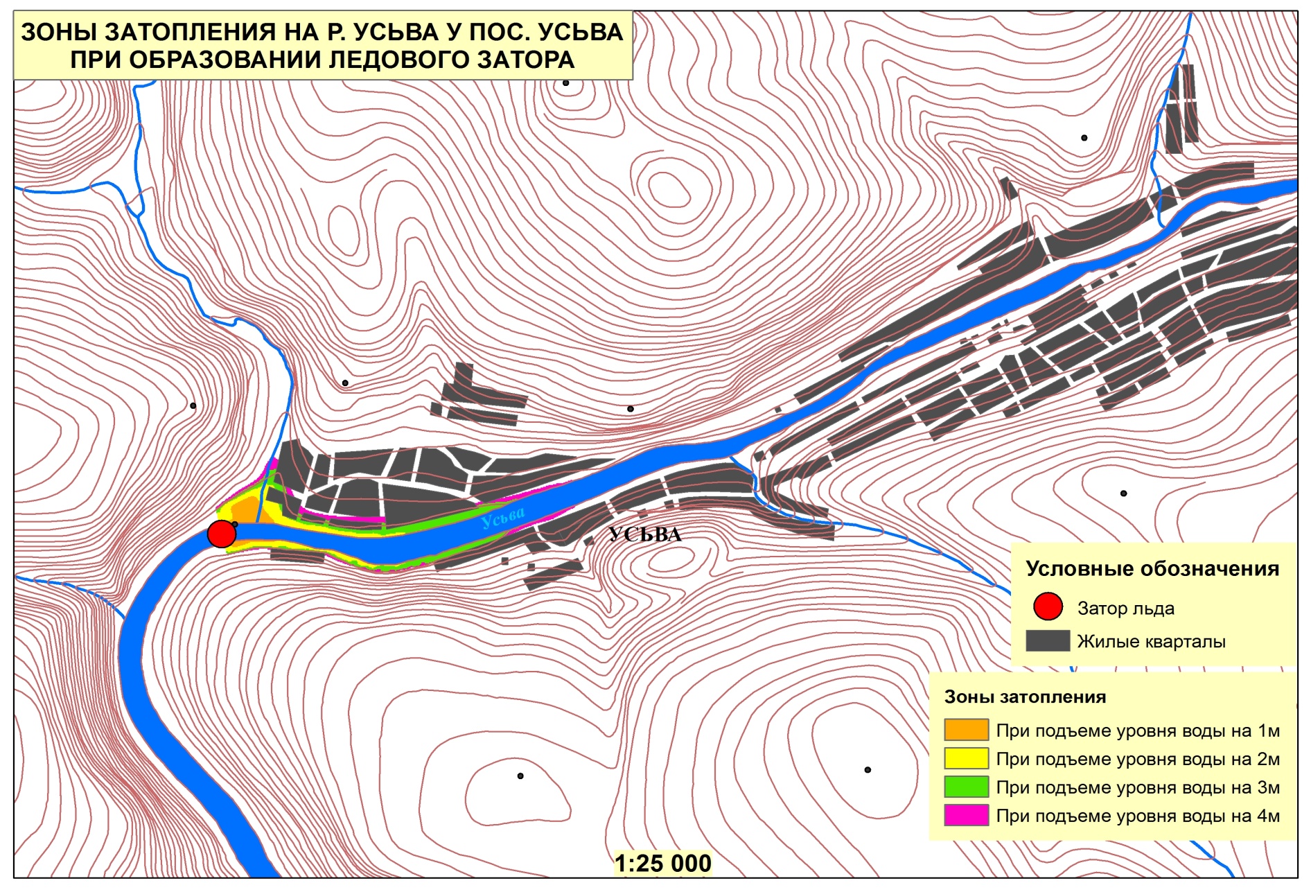
Identify the boundaries and areas of probable inundation during preset probability floods and high waters. Make lists of housing stock, economy, social infrastructure and other facilities, including those potentially dangerous in terms of ecology, population, wildlife population, agricultural land areas located in such zones. Develop measures to minimize damage and protect inhabited localities from floods.
Tasks:
- Identify the boundaries of the snow cover in the catchment area of the river basins.
- Study the ice conditions on the water bodies; make video and photo records of ice jams, ice gorges, ice-holes, flange ice.
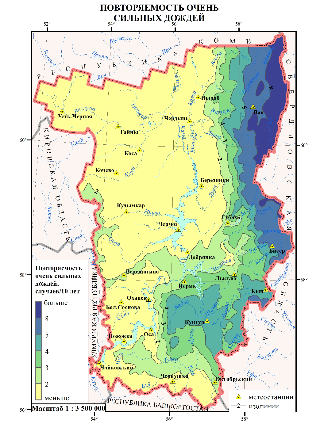
- Predict and analyze spring tides (high-water periods).
- Identify and make video and photo records of territories in the flooded areas; determine the boundaries of such areas, make lists of economic and social infrastructure facilities located within such areas.
- Identify and make video and photo records of events of water adverse effect.
- Provide hydrological characteristic of water bodies, flooding conditions; analyze the existing situation with flooding, underflooding in the region under study; determine the reasons of flooding and underflooding.
- Determine water level marks during preset probability high waters and floods and link them up to the existing system of Rosgidromet hydrometeorological observations.
- Make a list of housing, economic and social infrastructure facilities coming within the probable inundation areas during different probability floods and high water periods.
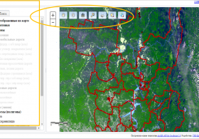
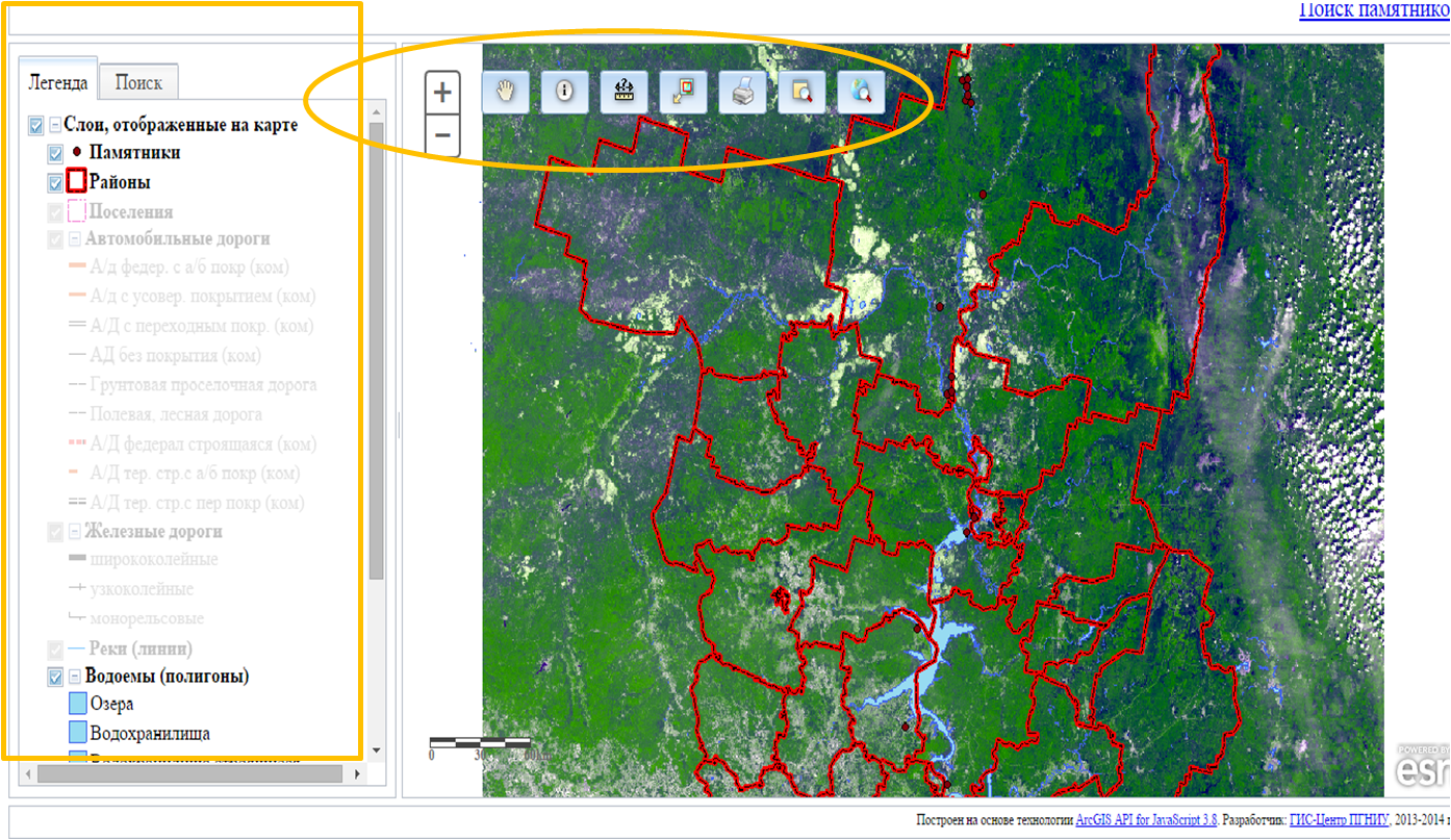
- Create electronic map thematic layers based on ArcGIS 9.x GIS-package.
- Develop recommendations for the protection of people and socially significant facilities from floods; long-run recommendations for the minimization of damages from floods.
Results:
- Prediction and monitoring of flood formation. Identified boundaries of probable inundation areas and actual inundation areas during spring tides.
- Identified boundaries and areas of probable inundation zones during preset probability floods and high-water periods; lists of housing, economic and social infrastructure facilities; determined number of people and animals and agricultural land area located in such zones.
- Developed actions for protection of people and economic facilities against floods and flood prevention measures.


