Short Description
Goals:
Identify the boundaries and areas of the possible submergence zones at the passage of floods and freshets of varying probability.
Identify the boundaries and areas of the possible submergence zones for set marks of water levels at the passage of floods and freshets correlating with the existing network of hydrometeorological observations of Russian HydroMeteoService.
Create the lists of housing fund objects, economy, communications and other objects, objects of potential risk on account of ecological conditions, construction projects, identify the areas of submergence, population, livestock, areas of agricultural lands, located in the possible submergence zones.
Tasks:
Conduct water surveys.
Conduct the inventory of objects located in the possible submergence zones at thepassage of floods and freshets of varying probability.
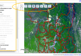
Create the electronic maps subject layers on the basis of GIS-package ArcView:
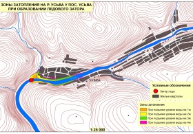
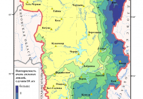
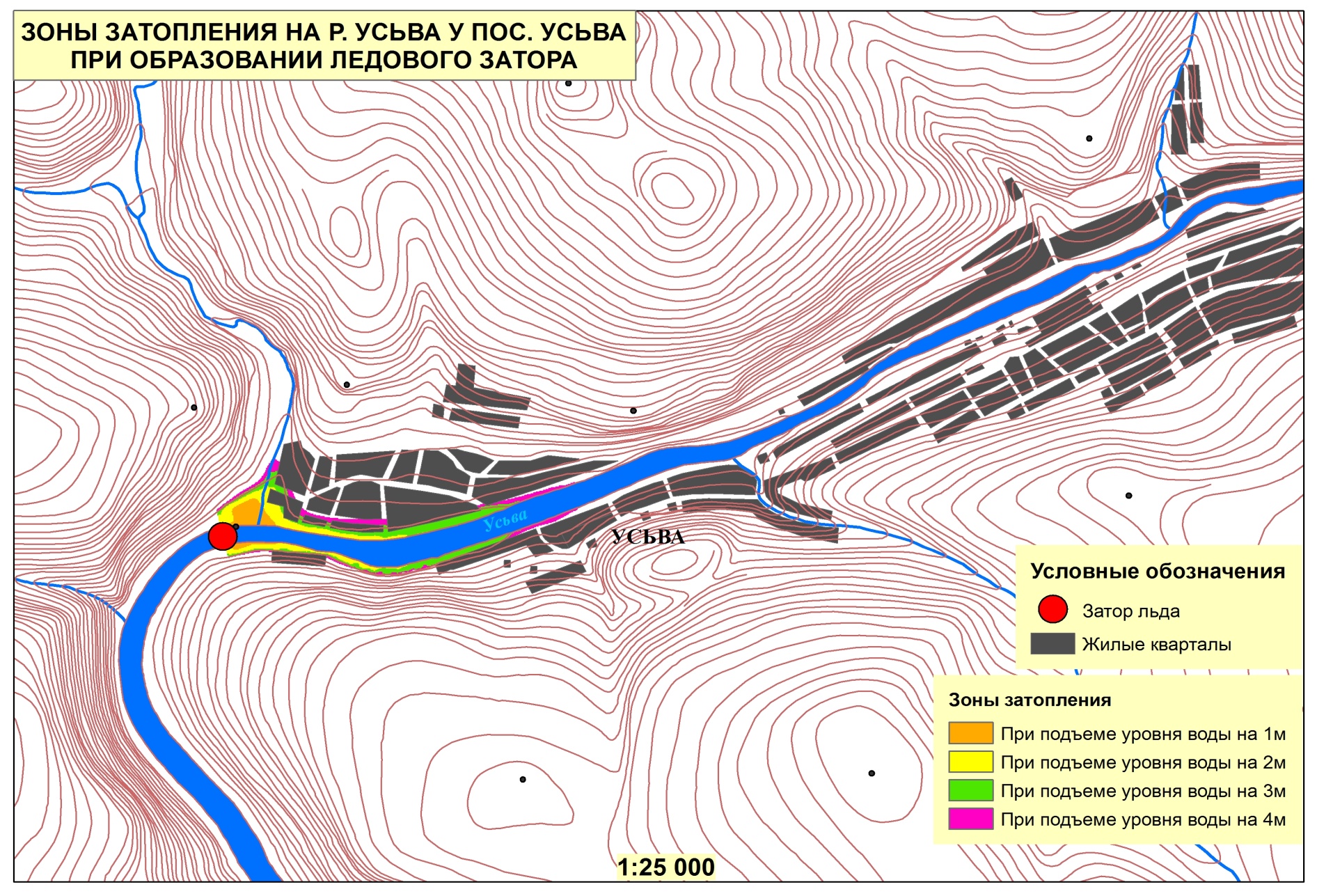
- possible submergence zones at the passage of freshets of varying probability;
- possible submergence zones at the passage of spring floods of varying probability;
- submergence zones for set marks of water levels ranging from critical mark of the inhabited locality submergence start to the level of water of 1% flood probability according to electronic maps created on the basis of GIS-package ArcView.
Correlate the marks of the submergence levels with the nearest hydrologic stations of Russian HydroMeteoService.
Results:
- Hydrological report.
- Electronic maps on the basis of GIS-package ArcView with the subject layers of the submergence zones boundaries.
- Cartographic material in the form of an atlas on paper medium.


