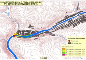
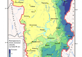
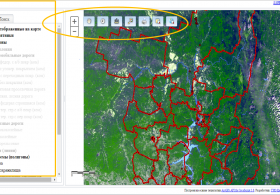
Short Description
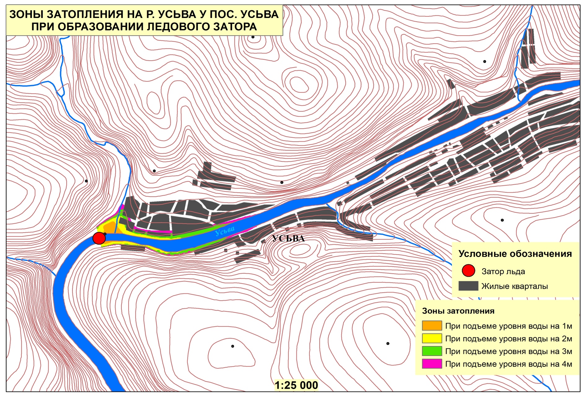
Goals: Create the cartographic database for identifying the zones of possible territory submergence at the passage of floods and freshets of high degree of probability.
Tasks:
- Create cartographic database of such territories of the objects under consideration near currents in inhabited localities and through the pond waterworks.
- Electronic mapping the possible submergence zones.
- Put together the GIS-project.
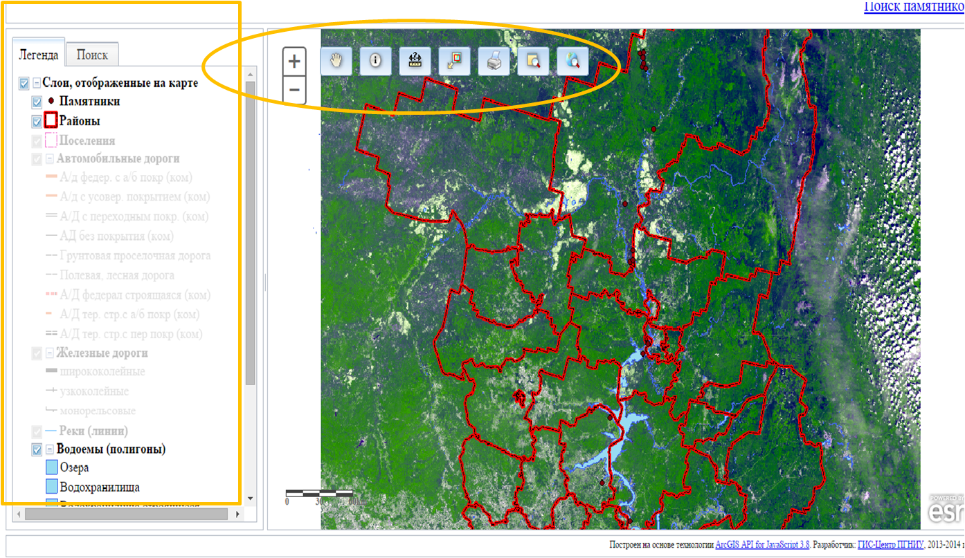
Results:
Subject layers:
- -water bodies;
- -built-up areas;
- -hydroelectric power stations;
- -administrative boundaries;
- -available land;
- -objects of social infrastructure and economy;
- -objects of potential ecological danger.


