Short Description
Goals: Create the two-level (regional and local) space monitor system for the Perm Region agricultural lands capable of providing the client with current reliable information about the state and development of the principal agricultural crops, and the efficient use of land resources.
Tasks:
- Elaborate the cartographic and attribute agricultural lands database containing cartographic and attribute information blocks.
- Carry out the compilation of cartographic and attribute databases in the framework of the current government contract implementation for the following administrative districts of Perm Region.
- Organize space monitor system for the Perm Region agricultural lands.
- Adapt the methods of agricultural crops capacity forecasting to the conditions of Perm Region.
- Elaborate the system of getting information products on the basis of remote probing data.
Results:
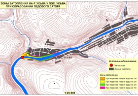
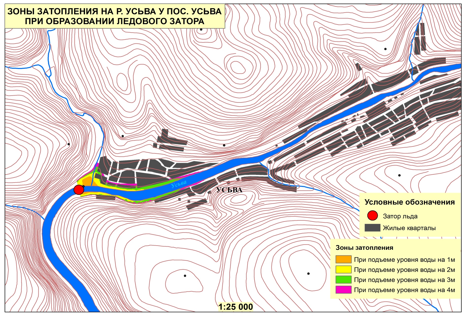
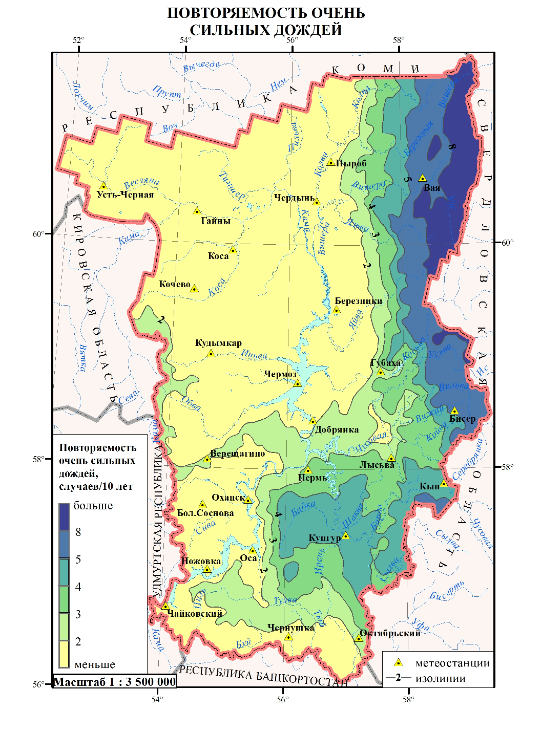
- Developed and populated cartographic database of agricultural lands.
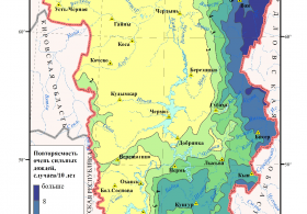
- Established system of getting crop capacity maps, drought maps, and state of the plants maps.
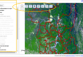
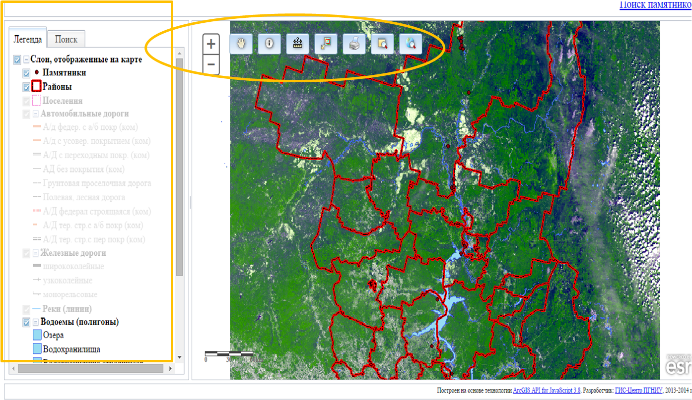
- Developed Website to access the remote probing data processing products.


