Short Description
The development of the technology for operational monitoring and floods forcasting during an ice obstruction formation based on the complexification of different types of spatial information.
The main results of the project:
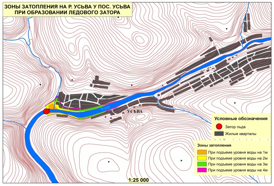
In the course of the project a methodology for the modelling of the flooding dynamics in the ice obstruction formation has been developed. The use of the methodology allows to predict the possible damage caused by flooding. Based on it the flooding simulation of two hazardous areas on the rivers of Perm Krai - the settlement of Usva, and the settlement of Bobrovka located on the Usva river has been conducted. The potential damage from flooding has been evaluated.
To estimate the spring runoff a new method of the calculation of maximum water reservers in snow cover has been developed. This method is based on the results of mesoscale numerical models of weather forecast WRF/ARW, and takes into account the snowmelt during thaws, snow cover evaporation, and the effect of different types of forest vegetation.
The mathematical-cartographic model of the formation and melting of snow cover has been created and adopted to the the conditions of the investigated area. This model can be used for the prediction of maximum water spring tide intensity. A software module for calculating the intensity of snowmelt processes has been developed in the framework of the geographic information system ArcGis 10.1. The results validation of the snowmelt spatial simulation on the basis of data from ground and satellite monitoring has been carried out on the materials of 2010 - 2013. In most cases, the good agreement between the calculated and actual data on snow cover area of the site and the water reserves in snow has been confirmed.
The database of dangerous hydrological phenomena in the flooding period on the territory of Perm Krai has been developed and completed.


