Short Description
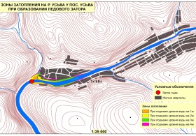
Goals: Visualization on large-scale electronic maps zones of possible submergence in case of the hydroelectric power stations emergencies and at the passage of extremely high floods according to high marks provided by the Kama branch of the Federal State Unitary Enterprise Russian Scientific Research Institute of the Water Resources Complex Use and Conservation.
Tasks:
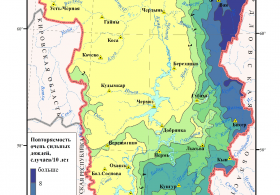
- Set up a cartographic database to identify the possible territory submergence zones at the passage of floods and freshets of high degree of probability.
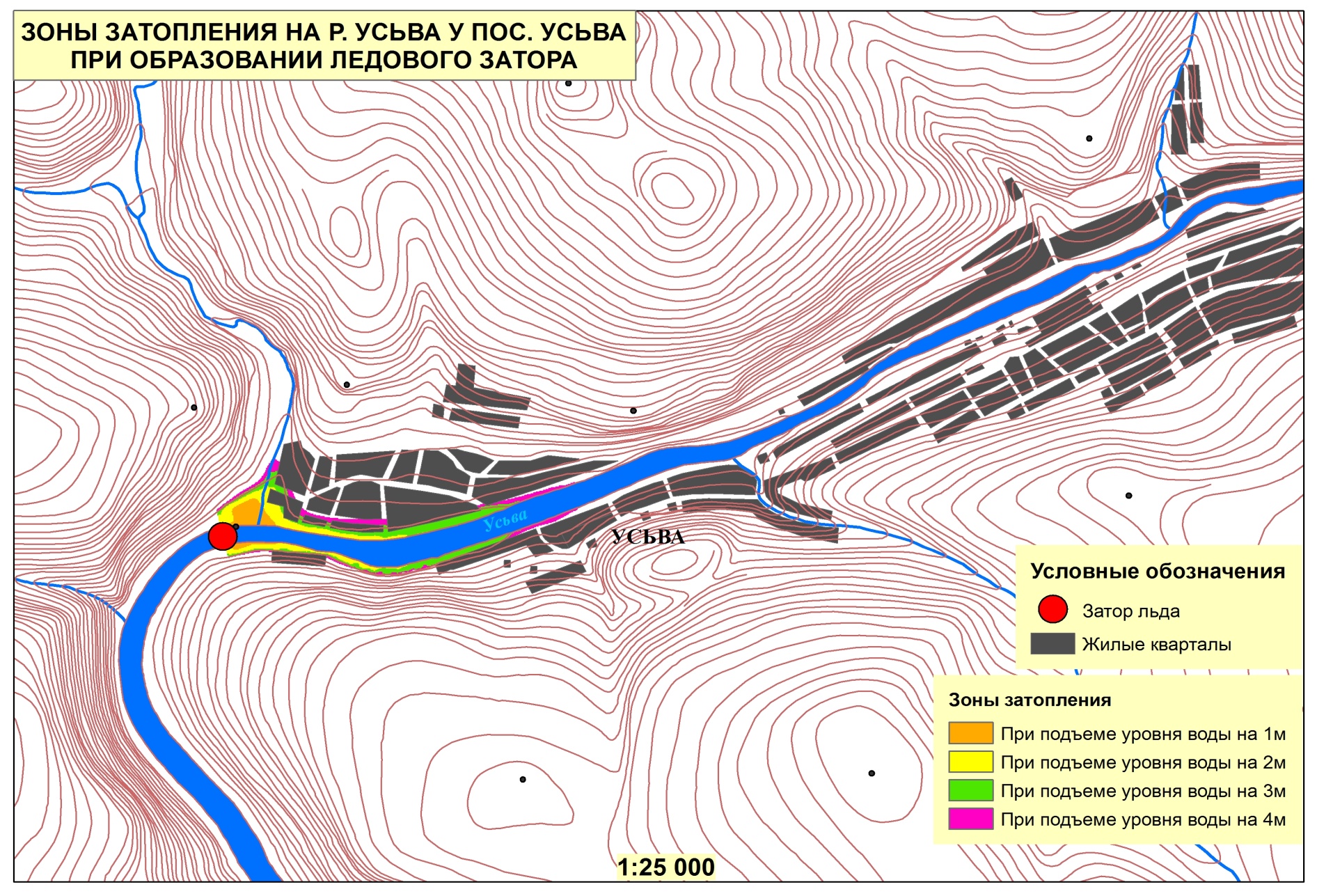
- Visualization on large-scale electronic maps zones of possible submergence in case of the hydroelectric power stations emergencies and at the passage of extremely high floods according to high marks provided by the Kama branch of the Federal State Unitary Enterprise Russian Scientific Research Institute of the Water Resources Complex Use and Conservation.
Results:
- Assessment of the hydroelectric power station technical conditions with the enclosed photographs, proposals for technical-organizational measures aimed at accident prevention at the hydroelectric power station; conclusion of the possibility and conditions of further exploitation.
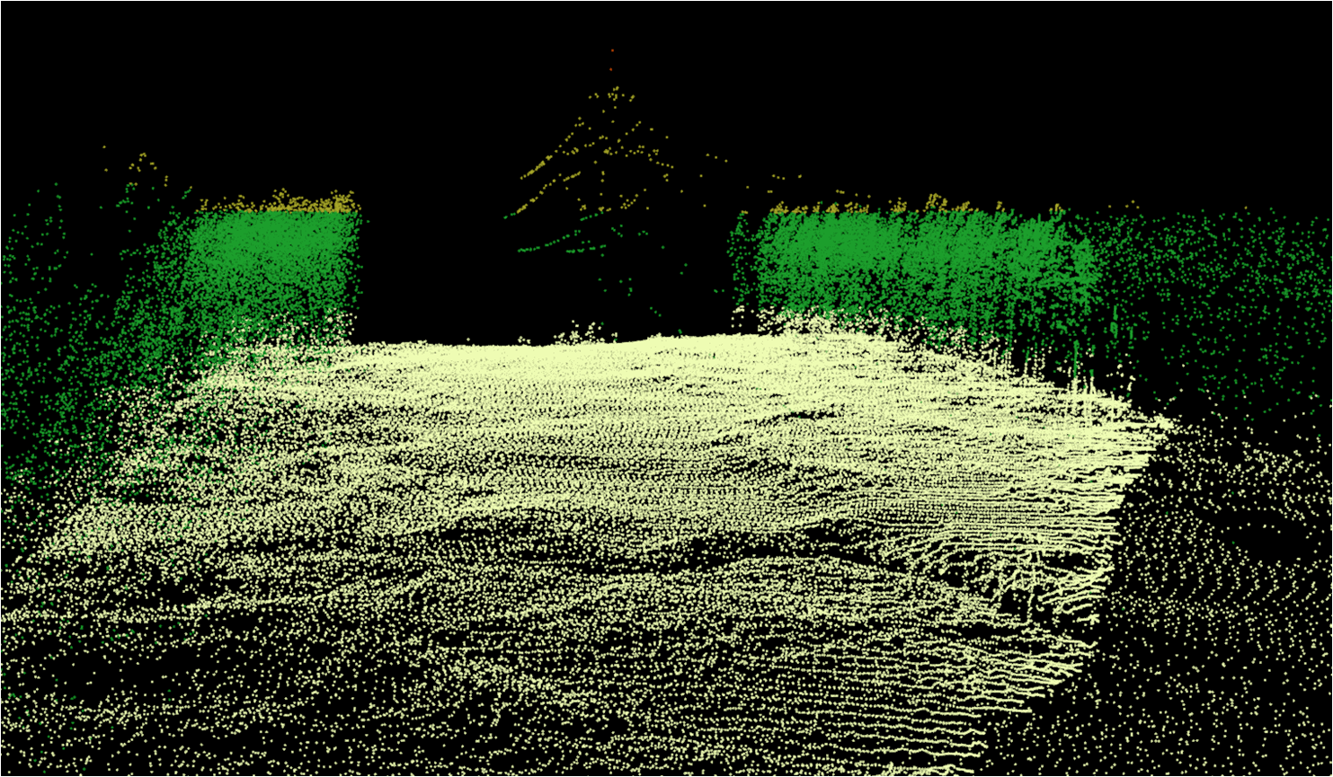
- Subject layers; digital relief model from the M:1 10 000 or M:1 25 000 scale maps in the hydroelectric power station zone and the possible submergence zone; water bodies; residential areas; hydroelectric power stations.


